Category:Wold Newton, East Riding of Yorkshire
Jump to navigation
Jump to search
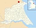
English: Wold Newton is a small Yorkshire Wolds village and civil parish in the East Riding of Yorkshire, England. It is situated approximately 9 miles (14 km) south of Scarborough and 9 miles (14 km) north west of Bridlington. The hamlet of Fordon is also part of the civil parish of Wold Newton. According to the 2001 UK census, Wold Newton parish had a population of 291.
village and civil parish in East Riding of Yorkshire, UK  | |||||
| Upload media | |||||
| Instance of | |||||
|---|---|---|---|---|---|
| Location | East Riding of Yorkshire, Yorkshire and the Humber, England | ||||
 | |||||
Subcategories
This category has the following 4 subcategories, out of 4 total.
Media in category "Wold Newton, East Riding of Yorkshire"
The following 174 files are in this category, out of 174 total.
-
 A road full of tractor (geograph 5197672).jpg 640 × 511; 54 KB
-
 A small reservoir off North Cotes Road (geograph 5525483).jpg 1,024 × 768; 190 KB
-
 Above Line Plantation (geograph 5197670).jpg 640 × 480; 51 KB
-

-
 Bench on Rainsburgh Lane. Wold Newton (geograph 5171694).jpg 640 × 458; 65 KB
-
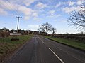
 Burton Fleming Road (geograph 5171723).jpg 640 × 480; 72 KB
-
 Burton Fleming Road (geograph 6467531).jpg 800 × 535; 105 KB
-
 Burton Fleming Road (geograph 6467573).jpg 800 × 600; 117 KB
-
 Burton Fleming Road (geograph 6472536).jpg 1,024 × 768; 174 KB
-
 Bus shelter, Wold Newton (geograph 2724655).jpg 1,024 × 768; 199 KB
-
 Bus stop and shelter, Wold Newton (geograph 5171715).jpg 640 × 480; 96 KB
-
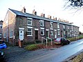
 Church Row Cottages - geograph.org.uk - 1282472.jpg 640 × 480; 106 KB
-
 Church Row, Wold Newton (geograph 2724648).jpg 1,024 × 768; 149 KB
-
 Close up, George VI postbox on former Post Office, Wold Newton (geograph 5178305).jpg 1,321 × 2,752; 487 KB
-
 Cottages Wold Newton - geograph.org.uk - 1385803.jpg 640 × 480; 59 KB
-
 Country crossroads (geograph 6090651).jpg 1,024 × 768; 146 KB
-
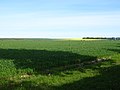
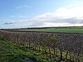
 Crop field and hedgerow near Wold Newton (geograph 6468393).jpg 800 × 600; 119 KB
-
 Crop field and hedgerow off Burton Fleming Road (geograph 6467543).jpg 800 × 600; 131 KB
-

-
 Crop field and hedgerow, Wold Newton Field (geograph 6468401).jpg 800 × 600; 149 KB
-
 Crop field and woodland. Wold Newton (geograph 5171693).jpg 640 × 480; 64 KB
-
 Crop field near Mill Farm (geograph 5197676).jpg 640 × 480; 58 KB
-
 Crop field near Wold Newton Grange (geograph 6467548).jpg 800 × 600; 93 KB
-
 Crop field near Woodside (geograph 5171689).jpg 640 × 480; 52 KB
-
 Crop field south of Burton Fleming Road (geograph 6467569).jpg 1,024 × 659; 179 KB
-
 Crop field towards woodland (geograph 6467556).jpg 800 × 600; 114 KB
-
 Crop field, Wold Newton Field (geograph 6468404).jpg 800 × 600; 124 KB
-
 East Field (geograph 2723902).jpg 1,024 × 768; 109 KB
-
 Electricity supply pole and boundary marker (geograph 6468433).jpg 737 × 800; 132 KB
-
 Entering Wold Newton (geograph 5171673).jpg 640 × 480; 59 KB
-
 Entering Wold Newton (geograph 5171726).jpg 640 × 480; 79 KB
-
 Entering Wold Newton from the North (geograph 5738268).jpg 1,024 × 765; 498 KB
-
 Entering Wold Newton, East Yorkshire (geograph 2748850).jpg 800 × 600; 100 KB
-
 Entrance to The Grange (geograph 6472533).jpg 1,024 × 768; 284 KB
-
 Entrance to Westfield House (geograph 2724672).jpg 1,024 × 768; 137 KB
-
 Farm buildings off North Cotes Road (geograph 2319189).jpg 800 × 600; 204 KB
-
 Farm buildings, Wold Newton (geograph 6468387).jpg 640 × 480; 79 KB
-
 Farm Track - geograph.org.uk - 1804228.jpg 2,876 × 1,652; 1.3 MB
-
 Farm track off Butt Lane near Wold Newton (geograph 6468395).jpg 800 × 600; 117 KB
-
 Farm Track South of The Grange - geograph.org.uk - 1282406.jpg 640 × 480; 81 KB
-
 Farmland SE Of Wold Newton - geograph.org.uk - 373211.jpg 640 × 480; 109 KB
-
 Farmland West of Wold Newton - geograph.org.uk - 1282513.jpg 640 × 480; 71 KB
-
 Farmland, Westfield Farm - geograph.org.uk - 382876.jpg 640 × 480; 68 KB
-
 Field being harrowed off North Cotes Road (geograph 5521292).jpg 1,024 × 768; 161 KB
-
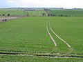
 Field near Wold Newton (geograph 6468399).jpg 800 × 600; 125 KB
-
 Fields near Westfield House Farm (geograph 6468411).jpg 800 × 600; 117 KB
-
 Fingerpost at the top of Skipper Lane (geograph 6468418).jpg 800 × 600; 191 KB
-
 Fingerpost near the mere, Wold Newton (geograph 6468367).jpg 640 × 480; 109 KB
-
 Fingerpost on Burton Fleming Road (geograph 6467534).jpg 800 × 600; 156 KB
-
 Footbridge, south side of the pond, Wold Newton (geograph 2724661).jpg 1,024 × 768; 152 KB
-
 Footpath through North Dale (geograph 6649742).jpg 4,608 × 3,456; 3.8 MB
-
 Former Post Office, Wold Newton (geograph 5178306).jpg 2,697 × 1,766; 943 KB
-
 Gappy hedge along Burton Fleming Road (geograph 2723819).jpg 1,024 × 768; 196 KB
-
 Gappy hedge alongside a crop field (geograph 2723857).jpg 1,024 × 768; 173 KB
-
 Gate into East Field, off Burton Fleming Road (geograph 2723886).jpg 1,024 × 768; 187 KB
-
 Gated field entrance off Burton Fleming Road (geograph 6467579).jpg 640 × 480; 95 KB
-
 George VI postbox on former Post Office, Wold Newton (geograph 5178304).jpg 1,686 × 2,354; 771 KB
-
 Heading east towards Wold Newton (geograph 2748846).jpg 800 × 600; 83 KB
-

-
 Heading west on North Cotes Road (geograph 5197677).jpg 640 × 480; 58 KB
-
 Hedgerow, Wold Newton Field (geograph 5171718).jpg 640 × 480; 67 KB
-
 House on Back Street. Wold Newton (geograph 5171703).jpg 640 × 480; 58 KB
-
 House on Laking Lane, Wold Newton (geograph 6467591).jpg 640 × 480; 74 KB
-
 House on Rainsburgh Lane, Wold Newton (geograph 5171691).jpg 640 × 480; 60 KB
-
 Houses on Rainsburgh Lane. Wold Newton (geograph 5171697).jpg 640 × 417; 46 KB
-
 K6 telephone box near the mere, Wold Newton (geograph 6468360).jpg 800 × 799; 190 KB
-
 K6 telephone box near the mere, Wold Newton (geograph 6468362).jpg 675 × 1,024; 217 KB
-
 Large crop field east of The Grange (geograph 2723661).jpg 1,024 × 768; 177 KB
-
 Left for Wold Newton, right for Hunmanby (geograph 2723676).jpg 1,024 × 768; 142 KB
-
 Linetop Road (geograph 5521436).jpg 1,024 × 768; 153 KB
-
 London (early types) Layer 7 obv (FindID 637965).jpg 10,200 × 14,039; 15.37 MB
-
 London (early types) Layer 7 reverses (FindID 637965).jpg 10,200 × 14,039; 15.47 MB
-
 London (early types) Layers 1-6 obv (FindID 637965).jpg 10,200 × 14,039; 18.51 MB
-
 London (early types) Layers 1-6 reverses (FindID 637965).jpg 10,200 × 14,039; 18.75 MB
-
 London (early types) Layers 8-9 obv (FindID 637965).jpg 10,200 × 14,039; 14.44 MB
-
 London (early types) Layers 8-9 reverses (FindID 637965).jpg 10,200 × 14,039; 14.5 MB
-
 Long straight north from Wold Newton (geograph 5738265).jpg 1,024 × 768; 421 KB
-
 Looking north across East Field (geograph 2723908).jpg 1,024 × 768; 119 KB
-
 Looking south along Skipper Lane (geograph 2748836).jpg 800 × 600; 90 KB
-
-
 Looking west along North Cotes Road (geograph 2321027).jpg 800 × 600; 196 KB
-
 Mill House Farm - geograph.org.uk - 1401221.jpg 640 × 480; 69 KB
-
 Millhouse Farm - geograph.org.uk - 203437.jpg 640 × 480; 109 KB
-
 Minor Road Junction - geograph.org.uk - 1385784.jpg 640 × 480; 80 KB
-
 Minor Road Through Cans Dale - geograph.org.uk - 1283199.jpg 640 × 480; 54 KB
-
 Minor Road Towards Foxholes - geograph.org.uk - 1282497.jpg 640 × 480; 68 KB
-
 Minor Road Towards Willerby Wold - geograph.org.uk - 1330295.jpg 640 × 480; 87 KB
-
 New use for old telegraph pole (geograph 2723853).jpg 1,024 × 768; 171 KB
-
 North Cotes Road (geograph 5197674).jpg 640 × 480; 53 KB
-
 North Cotes Road - geograph.org.uk - 1283144.jpg 640 × 480; 68 KB
-
 North Cotes Road - geograph.org.uk - 1283150.jpg 640 × 480; 110 KB
-
 North Cotes Road Becomes a Track - geograph.org.uk - 1283158.jpg 640 × 480; 64 KB
-
 Old Farm Machinery - geograph.org.uk - 203448.jpg 640 × 480; 225 KB
-
 Old Farm Track towards Westfield Farm - geograph.org.uk - 1283154.jpg 640 × 480; 109 KB
-
 Over the Gate - geograph.org.uk - 256980.jpg 640 × 480; 182 KB
-
 Panoramic view from North Cotes Road - geograph.org.uk - 1401229.jpg 640 × 480; 53 KB
-
 Pond on the Gypsey Race almost dry - geograph.org.uk - 1385793.jpg 640 × 480; 120 KB
-
 Pond Reflection at Wold Newton (geograph 3352300).jpg 4,358 × 2,989; 2.36 MB
-
 Potato field and Five Firs Plantation - geograph.org.uk - 5526626.jpg 1,024 × 768; 201 KB
-
 Potato harvesting, Wold Newton (geograph 5197662).jpg 640 × 480; 71 KB
-
 Pylons on the south side of Burton Fleming Road (geograph 2723846).jpg 1,024 × 768; 120 KB
-
 Rectangular crop field, south of Burton Fleming Road (geograph 2723870).jpg 1,024 × 768; 182 KB
-
 Reservoir along North Cotes Road - geograph.org.uk - 1401239.jpg 640 × 480; 90 KB
-
 Road bridge over the Gypsey Race (geograph 5741900).jpg 1,024 × 758; 392 KB
-
 Roman coin hoard (FindID 637965).jpg 2,256 × 1,496; 1.62 MB
-
 Roman coin hoard , bead (FindID 637965).jpg 3,648 × 2,432; 1.43 MB
-
 Roman coin hoard , nummus of Constantius I (FindID 637965).jpg 2,048 × 1,536; 1.04 MB
-
 Roman coin hoard , sherds (FindID 637965).jpg 2,844 × 2,651; 3.78 MB
-
 Roman coin hoard , vessel (FindID 637965).jpg 2,759 × 3,751; 5.41 MB
-
 SE of Foxholes - geograph.org.uk - 139465.jpg 640 × 480; 101 KB
-
 Seafood for sale, Wold Newton (geograph 6468365).jpg 1,600 × 1,208; 735 KB
-
 Skipper Lane towards Thwing (geograph 6468422).jpg 640 × 480; 109 KB
-
 Stubble field and Buerna Vista Farm (geograph 5525484).jpg 1,024 × 768; 180 KB
-
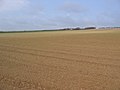
 Stubble field near Wold Newton (geograph 5526664).jpg 1,024 × 768; 182 KB
-
 Stubble field off North Cotes Road (geograph 5521301).jpg 1,024 × 768; 181 KB
-
 Stubble field, North Cotes (geograph 5197668).jpg 640 × 480; 62 KB
-
 Stubble field, Wold Newton (geograph 5197651).jpg 640 × 480; 66 KB
-
 Telephone box on Rainsburgh Lane. Wold Newton (geograph 5171698).jpg 640 × 480; 68 KB
-
 Telephone Exchange, Wold Newton (1) - geograph.org.uk - 1571501.jpg 640 × 480; 112 KB
-
 Telephone Exchange, Wold Newton (2) - geograph.org.uk - 1571511.jpg 640 × 480; 126 KB
-
 The Anvil Arms, Wold Newton - geograph.org.uk - 1293155.jpg 640 × 400; 240 KB
-
 The entrance to Wold Newton Grange (geograph 2749792).jpg 800 × 600; 170 KB
-
 The Gypsey Race near Willy Howe (geograph 6467525).jpg 600 × 800; 189 KB
-
 The Mere at Wold Newton (geograph 6630234).jpg 5,184 × 3,888; 5.25 MB
-
 The mere, Wold Newton (geograph 6468384).jpg 1,600 × 1,133; 441 KB
-
 The Old Post Office, Wold Newton (geograph 2724664).jpg 1,024 × 768; 145 KB
-
 The Old School, Wold Newton (geograph 5171730).jpg 640 × 480; 70 KB
-
 The road to Wold Newton (geograph 2724683).jpg 1,024 × 768; 121 KB
-
 The smaller pond, Wold Newton (geograph 2724665).jpg 1,024 × 768; 125 KB
-
 The Telephone Box at Wold Newton (geograph 3352298).jpg 4,310 × 3,204; 3.7 MB
-
 The track into Cans Dale - geograph.org.uk - 1402627.jpg 640 × 480; 134 KB
-
 The valley of the Gypsey Race (geograph 2724675).jpg 1,024 × 768; 181 KB
-
 The Village Pond, Wold Newton - geograph.org.uk - 1294521.jpg 640 × 427; 266 KB
-
 The western edge of East Field (geograph 2723899).jpg 1,024 × 768; 158 KB
-
 Track (permitted path) to Willy Howe Farm (geograph 6467502).jpg 640 × 511; 106 KB
-
 Track North of Wold Newton - geograph.org.uk - 203460.jpg 640 × 480; 81 KB
-
 Track to Millhouse Farm - geograph.org.uk - 1283142.jpg 640 × 480; 73 KB
-
 Track to The Grange - geograph.org.uk - 1282393.jpg 640 × 480; 134 KB
-

-
 Track to Wold Newton Grange (geograph 6467551).jpg 800 × 600; 220 KB
-
 Triangulation Pillar - geograph.org.uk - 1283169.jpg 640 × 480; 91 KB
-
 Triangulation Pillar No. S6335 - geograph.org.uk - 149647.jpg 640 × 480; 106 KB
-
 Trier (A *--TR) Layer 8 obv (FindID 637965).jpg 10,200 × 14,039; 17.77 MB
-
 Trier (A *--TR) Layer 8 reverses (FindID 637965).jpg 10,200 × 14,039; 17.96 MB
-
 Turn left for Fordon (geograph 2724658).jpg 1,024 × 768; 155 KB
-
 VE Day, Laking Lane, Wold Newton (geograph 6467593).jpg 640 × 410; 96 KB
-
 View towards Wold Newton (geograph 5526662).jpg 1,024 × 768; 241 KB
-
 Village pond iced over at Wold Newton (geograph 5739909).jpg 1,024 × 768; 449 KB
-
 Village Pond, Wold Newton (geograph 5171700).jpg 640 × 480; 59 KB
-
 Village pond, Wold Newton (geograph 6090655).jpg 1,024 × 737; 125 KB
-
 Warning of an almost 90 degree bend (geograph 3021797).jpg 1,024 × 768; 107 KB
-
 Watercourse near the mere, Wold Newton (geograph 6468381).jpg 800 × 600; 202 KB
-
 Well-maintained roadside hedge (geograph 2724678).jpg 1,024 × 768; 149 KB
-
 Wesleyan Chapel, Wold Newton (geograph 5171733).jpg 640 × 480; 70 KB
-
 West Dale - geograph.org.uk - 203443.jpg 640 × 480; 130 KB
-
 West of Wold Newton - geograph.org.uk - 149640.jpg 640 × 480; 87 KB
-
 Westfield House Farm (geograph 6468416).jpg 800 × 600; 111 KB
-
 Wold Newton (geograph 2217478).jpg 640 × 480; 86 KB
-
 Wold Newton Barrow - geograph.org.uk - 1098.jpg 640 × 423; 42 KB
-
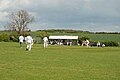 Wold newton cricket.jpg 270 × 181; 8 KB
-
 Wold Newton Field (geograph 5171720).jpg 640 × 480; 56 KB
-
 Wold Newton Gas Installation, North Cotes Road (geograph 2319193).jpg 800 × 600; 301 KB
-
 Wold Newton Grange - geograph.org.uk - 382880.jpg 640 × 480; 111 KB
-
 Wold Newton hoard as it was found.jpg 4,000 × 2,248; 2.99 MB
-
 Wold Newton Larger Pond - geograph.org.uk - 1282456.jpg 640 × 480; 111 KB
-
 Wold Newton Pond - geograph.org.uk - 1282436.jpg 640 × 480; 75 KB
-

-
 Wold Newton to the sea- aerial 2018 (geograph 5720700).jpg 640 × 427; 55 KB
-
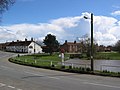 Wold Newton village.jpg 640 × 480; 67 KB
-
 Wold Newton, East Riding of Yorkshire UK parish locator map.svg 1,425 × 1,107; 1.68 MB
-
 Wolds Farmland - geograph.org.uk - 1282550.jpg 640 × 459; 72 KB
-
 Wolds farmland, North Cotes (geograph 5197665).jpg 640 × 480; 68 KB
-
 Wolds view near Wold Newton - geograph.org.uk - 1401252.jpg 640 × 480; 47 KB
-
 Yorkshire Wolds - geograph.org.uk - 147481.jpg 640 × 480; 106 KB
.jpg)
.jpg)
.jpg)
.jpg)
.jpg)
.jpg)
.jpg)
.jpg)
.jpg)
.jpg)
.jpg)

.jpg)
.jpg)

.jpg)
.jpg)
.jpg)
.jpg)
.jpg)
.jpg)
.jpg)
.jpg)
.jpg)
.jpg)
.jpg)
.jpg)
.jpg)
.jpg)
.jpg)
.jpg)
.jpg)
.jpg)
.jpg)
.jpg)
.jpg)
.jpg)

.jpg)


.jpg)
.jpg)
.jpg)
.jpg)
.jpg)
.jpg)
.jpg)
.jpg)
.jpg)
.jpg)
.jpg)
.jpg)
.jpg)
.jpg)
.jpg)
.jpg)
.jpg)
.jpg)
.jpg)
.jpg)
.jpg)
.jpg)
.jpg)
.jpg)
.jpg)
.jpg)
.jpg)
_Layer_7_obv_(FindID_637965).jpg)
_Layer_7_reverses_(FindID_637965).jpg)
_Layers_1-6_obv_(FindID_637965).jpg)
_Layers_1-6_reverses_(FindID_637965).jpg)
_Layers_8-9_obv_(FindID_637965).jpg)
_Layers_8-9_reverses_(FindID_637965).jpg)
.jpg)
.jpg)
.jpg)
.jpg)
.jpg)


.jpg)
.jpg)


.jpg)

.jpg)
.jpg)
.jpg)

.jpg)
.jpg)
.jpg)
.jpg)
.jpg)
.jpg)

.jpg)
.jpg)
.jpg)
.jpg)
.jpg)
.jpg)
.jpg)
.jpg)
_-_geograph.org.uk_-_1571501.jpg)
_-_geograph.org.uk_-_1571511.jpg)

.jpg)
.jpg)
.jpg)
.jpg)
.jpg)
.jpg)
.jpg)
.jpg)
.jpg)

.jpg)

.jpg)
_to_Willy_Howe_Farm_(geograph_6467502).jpg)


.jpg)


_Layer_8_obv_(FindID_637965).jpg)
_Layer_8_reverses_(FindID_637965).jpg)
.jpg)
.jpg)
.jpg)
.jpg)
.jpg)
.jpg)
.jpg)
.jpg)
.jpg)
.jpg)


.jpg)
.jpg)


.jpg)
.jpg)


.jpg)


.jpg)

